Table of Contents
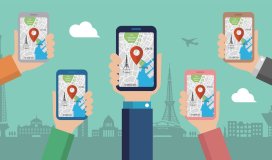
Google Maps is a powerful navigation tool that most of us use daily. It is an incredibly versatile tool that one can use for everything from finding directions for a memorable travel experience to tracking down a nearby restaurant. Since its inception in 2005, Google Maps has grown so ubiquitous and beneficial that it’s difficult to recall how we moved about without it. But even if you use Maps all the time, there are probably still some tricks up its sleeve that you don’t know about. This post offers you some of our favourite Google Maps tips and tricks and explains how to use them to experience pro travel. These tips are perfect for travellers, explorers, and anyone who wants to get more out of their Google Maps experience. So without further ado, let’s jump in!
Google Maps can be an incredibly useful tool, but what happens when you lose your phone signal and can’t access it? There may be times when you’re in an area with no service and need to find an alternate route. This setback can ruin your road trip experience. Luckily, you can download routes ahead of time on Google Maps and save them offline, so you can still get where you need to go even if you can’t use your phone.
If you want to check it out:
This one can come in handy for a solo road trip tip. One of our favourite pastimes is to head for a drive on a nice day. However, finding a parking spot can be challenging when going to a new place or a busy area. Google Maps has a new feature to help you find a parking space.
If you want to check it out:
Google Maps is a great way to SEE how busy businesses are and which are the best places to go shopping. You can see the business, its address, hours of operation, and customer ratings. It is an insightful way to determine if a company is worth your time. Allow Maps to show you how long you’ll have to wait before going to the grocery store or your favourite restaurant.
If you want to check it out:
The Google Maps Street View feature is a fantastic resource to help you explore the world around you. With Street View, you can view panoramic images of streets and locations all over the globe. You can also use Street View to preview a destination before visiting it or check out a new neighbourhood before leaving for that much-awaited solo female road trip.
If you want to check it out:
A little digging into the Google Maps code reveals that the possibility of time travel is hidden in the maps themselves. Google Maps provides a little-known function that allows you to view Street View for any place at various periods in the past. This one is only available from the desktop site. While this doesn’t offer a way to journey through time physically, it provides a fascinating glimpse and offers a fictitious memorable travel experience.
If you want to check it out:
When walking in an unfamiliar city, it can be hard to know which way to go. The blue dot on the map always points in the direction you’re supposed to go, right? Wrong! The blue dot is not a physical object; it’s just a marker that shows your location on the map. When you’re looking at a map, your blue dot will always point in the direction of your phone. Google Maps has a “Live View” walking navigation option which can be toggled on in the app. This mode displays a live camera feed of your surroundings, orienting you as you walk towards your destination.
If you want to check it out:
Google Maps is an excellent app for getting around, but there are a lot of features that many people don’t know about. This article proves that Google Maps can be used for so much more. The list comprises some of our favourite Google Maps tricks and how to use them. With these tricks, you can plan your travel experience like a pro. If you want to explore more of what Google Maps offers, embark on a journey and experience it firsthand.
Steps:
1. Open the Google Maps app on your Android phone or tablet.
2. Search for a location or touch on the map to get directions.
3. Tap Directions in the lower-left corner.
4. Select a mode of transportation.
5. Other routes will be shown in grey on the map if they are available.
6. To begin navigating, press the Start button.
Steps:
1. Locate your My Map
2. Login and launch Google Maps.
3. Go to Menu – Your locations – Maps.
4. Select it and then click Open in My Maps to modify a map. You’ll be sent to My Maps, where you can make changes to your map.
You must opt into revealing your whereabouts to a person you allow to follow. So tracking you without your knowledge or agreement is impossible.
When following a route on Google Maps, the app will advise you on which lane to stay in or shift to as you approach a bend or turn.
To avoid traffic on the best route for a road trip in India, depart early in the morning, before 6 a.m. When travelling by car, you should avoid peak hour traffic by starting your journey early in the morning. To prevent unnecessary delays, try to leave the city and get on the highway before 7 a.m.